(Photo Credit: KenKay Associates)
Experts expect more intense cycles of drought and flooding to be a common occurrence in the future. It is imperative that we capture and bank storm water during wet years, so it is available during periods of drought.
California has dramatically more storage capacity in underground aquifers than is available in surface level facilities. Further, natural groundwater recharge and storage is comparatively inexpensive, amounting to about one-sixth the cost of other options. Read a summary of recommendations in the action sheet Leaders Recommend Measures for Maximizing Groundwater Recharge. (The full list of recommendations can be found here.)
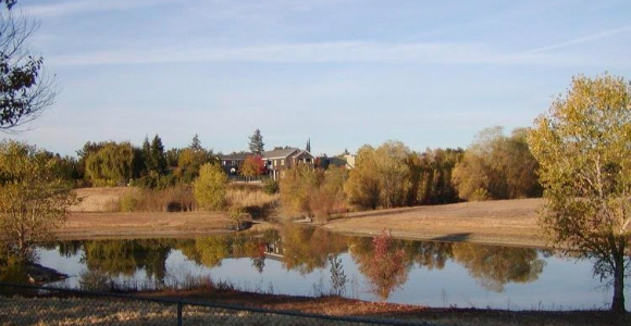
Sadly the natural recharge of groundwater has, over the past century, been disrupted by local land use decisions. We have built on and paved our natural landscapes, drained agricultural lands, filled in wetlands, and channelized our rivers, resulting in the loss of untold acre feet of water which otherwise would have been stored underground
This happened without local jurisdictions – nor State and federal government – being aware of the water shortage problem that would eventually develop. While the State of California requires cities and counties to adopt general plans that define where and how they will grow, nowhere in general plan law is there reference to identifying and preserving land well suited to natural groundwater recharge.
Meanwhile, without land available to absorb storm water and urban runoff, floods became an increasing problem. Local flood control districts were established to reduce flood risks, but their solutions were primarily engineering ones – dams, storm drains, channelized rivers and levies. Because these flood control measures keep “unwanted water” away from the land, aquifer recharge was further stunted. Today, groundwater reserves are reduced to the point that the more shallow wells serving some communities are running dry.
Last year, the University of California’s Division of Agriculture and Natural Resources and the California Economic Summit brought together 25 innovative land use decision makers and 25 water experts to determine how they might better work together to implement groundwater recharge policies and projects. Their conclusion, land use and water supply entities should reach out to flood control agencies to jointly identify and preserve lands for the dual purpose of recharging groundwater recharge and providing flood protection.
Recently UC researchers have explored a new idea, using storm water to recharge groundwater on agricultural lands. Scientific American identified their work as one of the 10 best ideas to save the planet.
Orchards have been identified where soils and underground hydrogeology quickly deliver water to the aquifer. Fruit trees have also been studied to find those that can tolerate standing water. UC Davis Professor Toby O’Geen has mapped locations throughout the state where the proper conditions exist. He concludes that if every appropriate site were to contain rather than drain storm water, an additional 30 million acre feet a year could be added to the aquifer. Researchers at UC Santa Cruz are testing this proposition on agricultural lands and their first year has produced positive results.
In the Fresno region, soil types and hydrogeology are homogenous. Rather than identifying individual recharge sites, the challenge is to preserve as much open space as possible. The City’s new general plan currently requires that half of all new development be restricted to already developed areas with a future objective of 100 percent infill.
The City currently owns one major groundwater recharge facility and has agreements with the Flood Control District to use flood control basins for recharge, yielding 50,000 acre-feet of water per year. Future plans include the lease or purchase of vacant parcels within City limits for recharge.
In 2014, dramatically decreasing groundwater supplies led to the enactment of the Sustainable Groundwater Management Act (SGMA). Newly formed SGMA agencies are required to develop plans for future groundwater sustainability in their water basins. Many will discover that land use, flood control and water agency cooperation will be required to achieve this goal.
This October, a gathering of 77 innovative land use decision makers, water districts, flood management districts, University researchers, and State officials developed a series of joint recommendations to further groundwater recharge by breaking down individual agency silos.
Some of those recommendations will be further explored during the 2017 Economic Summit in San Diego on November 2-3. Leaders at the Summit will seek to improve alignment between housing, water, transportation, and community design across the state. Registration and program information can be found on the 2017 Summit Registration page.
Judy Corbett is the retired executive director of the Local Government Commission and a leader in the Summit’s working landscapes action team.
The full list of recommendations to emerge from the October symposium can be found here.